SUN ACCESSIBILITY VS BUILDING HEIGHT MAPPING
Digital Tool for Urban Analysis
Partner | Lu Zhang
Fall 2016
Advisor | Andrew Witt
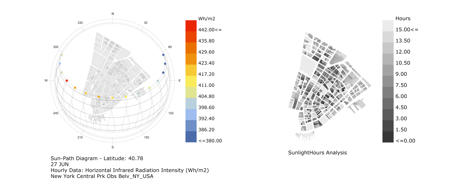
An exercise of mapping the sunlight access on the streets dominated by the streetscape is generated through reflecting the relations between the building heights and the amount of sun light that is captured on all surfaces in one day. The relations are expressed through comparison through curves, colors and solids. The specific site picked for this exercise is the Financial District of New York City, and the weather data are collected from New York State data website.
The intention of this exercise is to be able to expand the time scope from a day to a week, a month, a year or a decade, and applied to all different locations and cities for comparison. The visualization tends to appear comprehensive and legible. Eventually, it could become a design tool for urban designers and architects to understand the most effective urban configurations for a healthy urban environment.
Sunlight Hours mapping onto the site: Financial District of New York City
Grasshopper Definition
1. applying sunlight data onto the site 2. measure building height for categorization 3. overlay two layers of information in a geographical radial grid
Building Height = 0 meter 0 meter < Building Height < 14 meters
14 meter < Building Height < 35 meters 35 meters < Building Height


